Identity
Establishment details:
Founding Act PD 78/2001 (FEK Α΄66/6-4-2001)
Director:
Prof. Loupasakis Constantinos
Professor
Tel.: +30 210 772-2087
email: cloupasakis@metal.ntua.gr
Faculty Members:
Loupasakis Constantinos, Professor
Kalioras Andreas, Associate Professor
Tsangaratos Paraskevas, Assistant Professor
Contact:
National Technical University of Athens
School of Mining-Metallurgical Engineering
Iroon Polytechniou 9, Zografou
157 80 Athens, Greece
email: cloupasakis@metal.ntua.gr
Website:
https://www.metal.ntua.gr/?page_id=4789
Presentation of the Laboratory
The Laboratory of Engineering Geology – Hydrogeology (LEGAH) is an institutionalized Laboratory of the National Technical University of Athens, of the School of Mining-Metallurgical Engineering, of the Department of Geological Sciences. It was founded in 2001 after the division of the Laboratory of Applied Geology into a) Laboratory of Geology and b) Laboratory of Engineering Geology – Hydrogeology.
The scientific field of laboratory is related with the application of geological, engineering geological and hydrogeological knowledge in the design, development and operation of various technical and mining works. It is also related with the study of natural hazard phenomena, their evaluation, prevention and application of mitigation measures. Still with the study, exploitation, management of water resources and protection of groundwater and all subjects that concern Hydrogeology and Environmental Geology. In addition, field of interest are the investigation and analysis of thermo-metallic waters and bottled waters. The main research topics addressed include:
- The study and treatment of natural disasters (landslides, land subsidence, subsidence, soil erosion, floods).
- The simulation of hydrological processes in natural water systems (groundwater flow, mass and heat transfer).
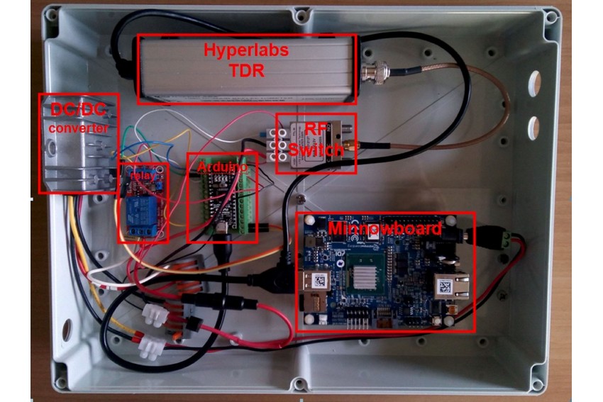
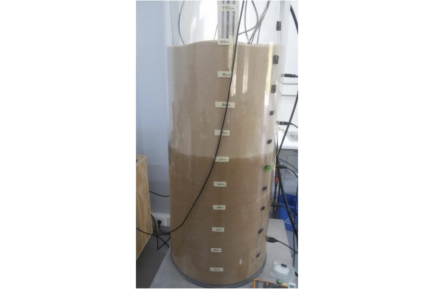
- The development of hydrology monitoring systems of the unsaturated zone (humidity and temperature sensors TDR/FDR).
- The management of research infrastructures of coastal water systems observatories.
- The development of digital platforms for the simulation of hydrological processes with free and open source software.
- The management and enrichment of underground aquifers.
- The application of Machine Learning and Deep Learning methods and techniques as well as advanced spatial analysis techniques in the management of natural disasters.
- Determining the effect of Climate Change on the occurrence of natural disasters.
- The Protection of Cultural Heritage (Investigation of geotechnical problems, foundation and reconstruction in monuments).
- The determination of the physico-mechanical properties of soil and rock formations (laboratory and on-site tests of Soil Mechanics – Rock Mechanics),
- Geological Suitability Studies (for housing and cities expansion projects, for placing industrial facilities and Sanitary Waste Disposal Sites, etc)
- Environmental protection through Environmental Geology,
- Controlling the Quality of water resources,
- The utilization of thermo-metallic and bottling waters.
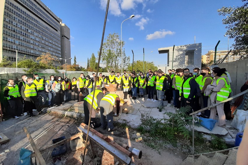
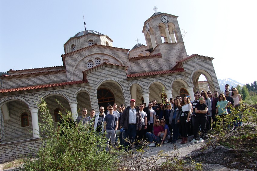
The aim of the educational program of the laboratory is to provide the necessary scientific engineering geological and hydrogeological knowledge to undergraduate students as well as to postgraduate students, creating scientists capable of successfully responding to the laboratory’s subject matter. For this reason, in addition to the lessons and laboratory exercises, educational excursions and field exercises are carried out so that our students can gain the necessary experience.
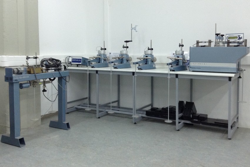
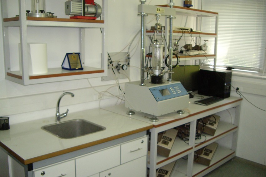
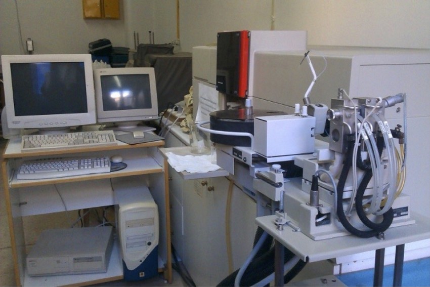
The laboratory of Engineering Geology and Hydrogeology is fully equipped with devices and units for the study of physical and mechanical properties of soil and rock formations. It covers almost all laboratory tests required to verify the geotechnical behavior of geological formations subject to intense situations, possessing the necessary equipment and specific units. In particular it possesses equipment, suitable for soil and rock preparation, a complete set of equipment and apparatus for making particle analysis and Atteberg limits. It also features the following equipment for determining the physical and mechanical properties, strength properties, shear strength, unconfined compression, one-dimensional solidification and triaxial stress values of soil specimens:
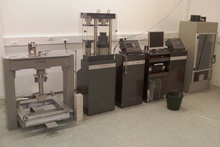
- Apparatus for determining the ratio of slake durability, Slake durability (ELE International).
- Appliances for front loading soil solidification (CONTROLS 26WF302), with cell solidification, electronic sensors, Wykeham Farrance.
- Automated soil solidification (GDS).
- Direct shear apparatus, (DIGISHEAR 27-WF2060, Wykeham Farrance).
- Bromhead Ring shear apparatus, (TORSHEAR 27-WF2202, Wykeham Farrance).
- Apparatus for determining the bearing capacity ratio, (CBR TESTER 34-T0106, CONTROLS).
- Triaxial stress apparatus, capacity 50KN, TriScan50, (Vj Technology).
- Apparatus for determining the shear strength of discontinuities, (Shear Voch MATEST).
- Point load testing apparatus, (ELE International).
- Portable Inclinometer system (Slope Indicator, up to 100m)
In addition the laboratory of Engineering Geology and Hydrogeology is fully equipped with devices and apparatus needed for evaluating the physical and chemical properties of surface and ground water bodies (WTW, Germany), devices for measuring ground water levels (GeoKon, up to 150m), and equipment for contacting microbiological analysis. Specifically it features:
- Conventional water level meters with the ability to measure up to a depth of 500m.
- Underground/surface water level measuring stations [consisting of: pressure/level & temperature measuring sensor, controller-LoRa transmitter,]
- Surface water level and velocity measurement recording stations [consisting of: Surface water level and velocity measurement system with radar technology sensor, photovoltaic cell energy supply subsystem, telemetry recorder with telecommunication equipment-LoRa transmitter]
- Autograph multi-parameter instrument for recording physico-chemical water parameters with the ability to measure pH, EC, DO, CI, T, Depth.
- Spectrophotometers.
- Flame photometer.
- Individual absorption (jointly with the Metallurgy Sector).
- Set for performing basic microbiological analyses.
- Portable flow rate measuring instrument
- Automatic weather station.
Also, together with the Laboratory of Tunneling Technology of the Mining sector, they have an automatic compression apparatus, with a capacity of 5000 kN, with control of 4 different special devices for performing compression, bending and triaxial loading tests on rock formations.
The Laboratory specializes in the development of predictive models that are mainly based on open source software and concern the simulation of natural catastrophic phenomena (landslides, soil erosion, flooding phenomena, land subsidence) as well as the production of spatial products of susceptibility, hazard and risk of the relevant phenomena. In addition, the Laboratory has developed a free open source platform for the simulation of groundwater flow and mass and heat transfer in porous media and the management of water resources and shallow geothermal fields (integrated in the QGIS platform). Some of the software’s which have been developed or operated by members of the laboratory are listed below:
- Development of a digital tool for managing hydrogeological databases
- Test Pump Analysis Software,
- Geographic Information Systems G.I.S,
- Hydrochemical data processing software,
- Software for archiving, reliability checking, processing and analysis of meteorological and river and spring supply data;
- Software for recording and statistical processing of discontinuities,
- Finite Element Geotechnical Model Solving Software,
- Open source software (WEKA, RStudio, PyCharm, Spyder).